A trip along the Blue Ridge Parkway in North Carolina would not be complete without a stop to hike the Graveyard Fields Loop Trail. This trail leads you through verdant forests with wildflowers, blueberries, and crystal-clear streams of the lower and upper waterfalls. Located in Pisgah National Forest near Asheville, this is an ideal hike for those seeking a moderate challenge with highly rewarding views.
We’ll explain details for getting the most out of Graveyard Fields Loop Trail by beginning your trek towards upper falls and finishing with the lower falls.
- Difficulty: Moderate
- Distance varies depending on your path.
- Length from parking lot to lower falls: 0.3 miles
- Length from parking lot to upper falls: 3.2 miles round trip
- Elevation gain: ~320 ft.
- Cost: Free in Pisgah National Forest
Location and Parking for Graveyard Fields Loop Trail
The Graveyard Fields Loop Trail is situated near Mile Marker 418.8 on the Blue Ridge Parkway within the Pisgah National Forest. This accessible location is found on the scenic drive that winds through the Blue Ridge Mountains of North Carolina.

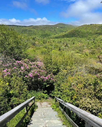
You can conveniently park your car at the designated parking lot, which serves as the starting point for the Graveyard Fields Loop Trail. From there, follow the trail head signs to embark on the hike down the staircase, either beginning on the path to the upper falls (towards the left end of the parking lot) or the lower falls (on the right near the restrooms).
It’s advisable to arrive early, especially during peak seasons of summer and fall, to secure a parking spot. This trailhead can get busy due to its popularity. Additionally, the parking lot provides easy access to restroom facilities and information boards that provide insights about the trail and the surrounding area.
History and Naming of Graveyard Fields
The name “Graveyard Fields” might evoke images of burial grounds, but the origins of this name are not related to actual graves. Instead, it refers to the sight witnessed by early travelers and settlers in the early 20th century.
A massive wildfire swept through the region in 1925, leaving behind a landscape that resembled a field of grave markers. The fire’s intensity and subsequent erosion of the soil led to the exposure of tree stumps that looked like tombstones, hence the name “Graveyard Fields.”
Over the years, nature has reclaimed the area. The landscape has transformed into a lush and picturesque setting that contrasts with its historical origins.
While the origin of the name may be unexpected, it serves as a reminder of the dynamic and evolving nature of landscapes, as well as the historical events that have shaped them. Hikers can experience the contrast between the trail’s tranquil beauty and the intriguing history behind its name.
Hike the Loop to the Lower and Upper Falls
There are a few different ways to hike the Graveyard Fields Loop. I’ll be detailing the path that I took and would recommend to others wanting to get the most out of this experience of seeing two beautiful waterfalls.
Graveyard Fields Upper Falls
From the trailhead, follow the staircase down immersing yourself in rhododendron bushes and mountain laurel greenery that becomes a canopy over the path. In August, the trail may be lined with wild blueberry bushes ripe for the picking.
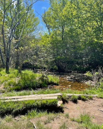
You’ll pass by grassy fields and have to cross the stream several times; once over a footbridge and once over a larger, sturdy bridge. Some of the terrain is rocky along this path, and can also become quite muddy depending on the trail’s conditions.
It is also easy to become lost or confused when hiking to upper falls. There are many different trails that intersect, and people have gone off trail often. Therefore, creating more footpaths and unfortunate erosion. In general, stick to the established trail. Remember that the upper falls is located to the west (go left) of the lower falls and parking lot.
About a mile past the open creek area, you’ll be close to the upper falls, which has two different sections (a lower and upper section) where you can view it from. These spur trails are steep and add some mileage, but are well worth it.

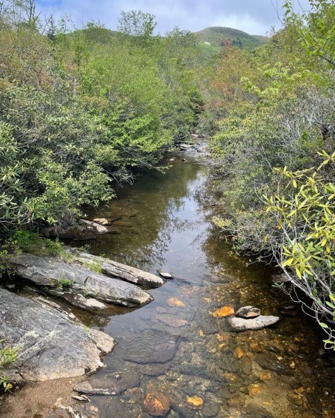
The lower section of upper falls showcases the Yellow Prong river sliding downwards across rocks and onto large boulders. It is more delicate of a view, and can be a teaser for the upper section above.
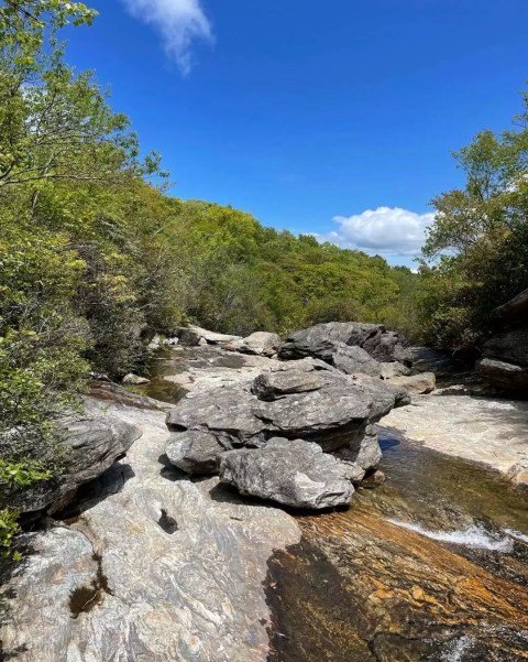
The upper section showcases the impressive cascading waters. Be careful around the water of the upper falls. The rocks can be extremely slippery (do not swim or jump from this waterfall).
Once you’ve soaked in the beauty of the Graveyard Fields Upper Falls, head back the way you came. That way you’re back on the loop trail and able to finish with the lower falls.
Graveyard Fields Lower Falls
As you’re walking through the valley, the trail gradually unveils the lower falls. You’ll hear the cascading water of the lower falls flowing over a series of big boulders. Getting closer to the lower falls, you’ll walk along wooden boardwalks. Plus, you’ll cross a bridge with directions to the lower falls viewing platform.
Flowing from the Yellowstone Prong, lower falls has beautiful, clear water that you can dip your feet into. With large boulders accessible steps away from the bridges, you can separate from the crowd and relax a bit here.
In the summer, lower falls is a popular spot for swimming and soaking your feet in the cold mountain water. However, there are no lifeguards and the rocks are very slippery, so swim at your own risk.
While I finished with the lower falls, hiking from the parking lot to this area would be a perfect trail for those seeking a short, less demanding hike that still delivers great views.
The paved path includes wooden stairs (with quite a few steps) with a distance of about 0.3 miles. The trail is shaded and lined with rhododendron bushes that may be in bloom depending on the season.
When to Plan Your Hike
If you’re driving along the Blue Ridge Parkway near Canton, NC, plan to include this stop no matter what the time of year. The parking lot is spacious, but will fill up quick during peak daytime hours. Try to make it to the trailhead either early in the morning or early evening to secure a parking spot.
Best Times of Year to Visit
Spring is a beautiful time to watch the greenery come to life in Pisgah National Forest. Summer is the optimal time to visit if you would like to cool off in the water. Or, you can dip into any of the other natural swimming holes in this western part of the state. Keep in mind, wild blueberries are ripe to pick in August.
Fall is the most popular time for hikers visiting the area because of the remarkable mountain foliage.
Nearby Hikes
On the Blue Ridge Parkway:
- Black Balsam Knob and Tennent Mountain via the Art Loeb Trail
- Sam Knob Trail
- Skinny Dip Falls
- Frying Pan Mountain
- Mount Pisgah Trail
Near Brevard and Transylvania County:
- Barnett Branch Falls
- Looking Glass Falls
- Looking Glass Rock Trail
- Sliding Rock
- Moore Cove Falls